Bike Portage County and Beyond
  • County Info and Trail Connections
    • Portage Parks Trails
    • Portage County Road Resources
    • Road Info for Nearby Counties
    • Connecting to the Western Reserve Greenway
    • Connecting to the Mill Creek Metroparks Bikeway
    • Connecting to the Towpath Trail
    • Connecting to the Maple Highlands Trail
    • Mahoning Valley and Iron Horse Trails
    • Connecting to Parma and the Northern Tier Route at Lakewood
    • Future Trails and Connections
  • Longer Trips - Cycle Touring
    • Planning a Bike Tour
    • The Ohio to Erie Trail
    • Ohio to Erie Trail Alternate to Ashtabula
    • The Erie Canalway Trail
    • North Bend Rail Trail, WV
    • Greenbrier River Trail, WV
    • Ghost Town Trail (and Hoodlebug)
    • Pine Creek Rail Trail (PA)
    • The GAP and C&O >
      • Connection by Trail to Reagan Airport
    • Cleveland Bypasses for the Northern Tier Route
    • Overview Maps
  • Beer:30 on the Bike Trail
  • E-bike Regulations
  • Contact
  • Blog

Overview Maps

1.  Local and Regional Trails and Some Possible Road Links
This interactive map shows the relationships between local county trails and an extended network.  This includes the Ohio to Erie Trail, GAP/C&O Trails, and the road link to Buffalo, where connections to the Erie Canalway can be made.  Some of the routes pictured here may not match any official routes exactly.  Visit the relevant pages on this site for more information and links to official sites.


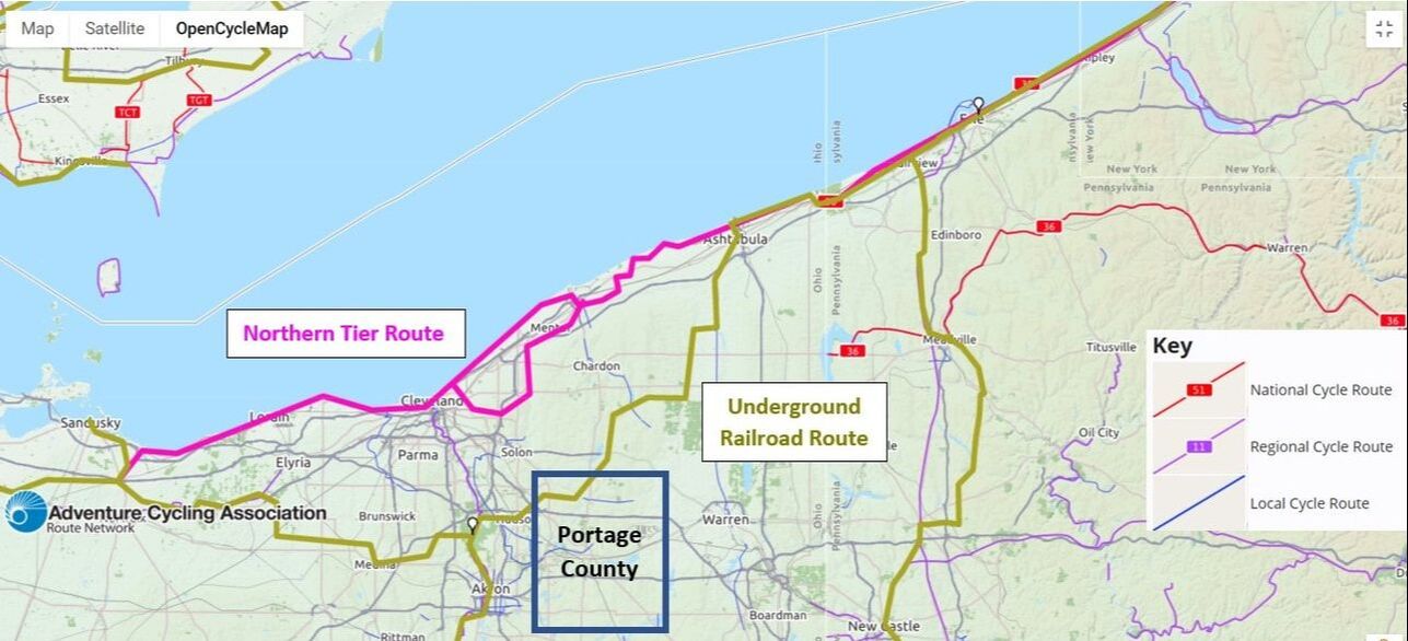
​2. Portage County and its Proximity to Adventure Cycling Routes
Two cross-country touring routes pass through or very near Portage County.  The Underground Railroad route cuts through the Akron area and across the northwest corner of our county.  The Northern Tier Trail runs east-west, just north of us.   Our local and regional bike trails and routes are also visible on this map.  Contact the Adventure Cycling Association to purchase navigation maps for their routes.  The routes pictured here are in a screen shot of free route approximations from their interactive map.  You will be able to zoom in on specific routes there.  The county rectangle and partial OpenCycleMap legend (also see the link to that site below) are my additions.
www.adventurecycling.org/routes-and-maps/adventure-cycling-route-network/interactive-network-map/
​
www.opencyclemap.org/

Picture
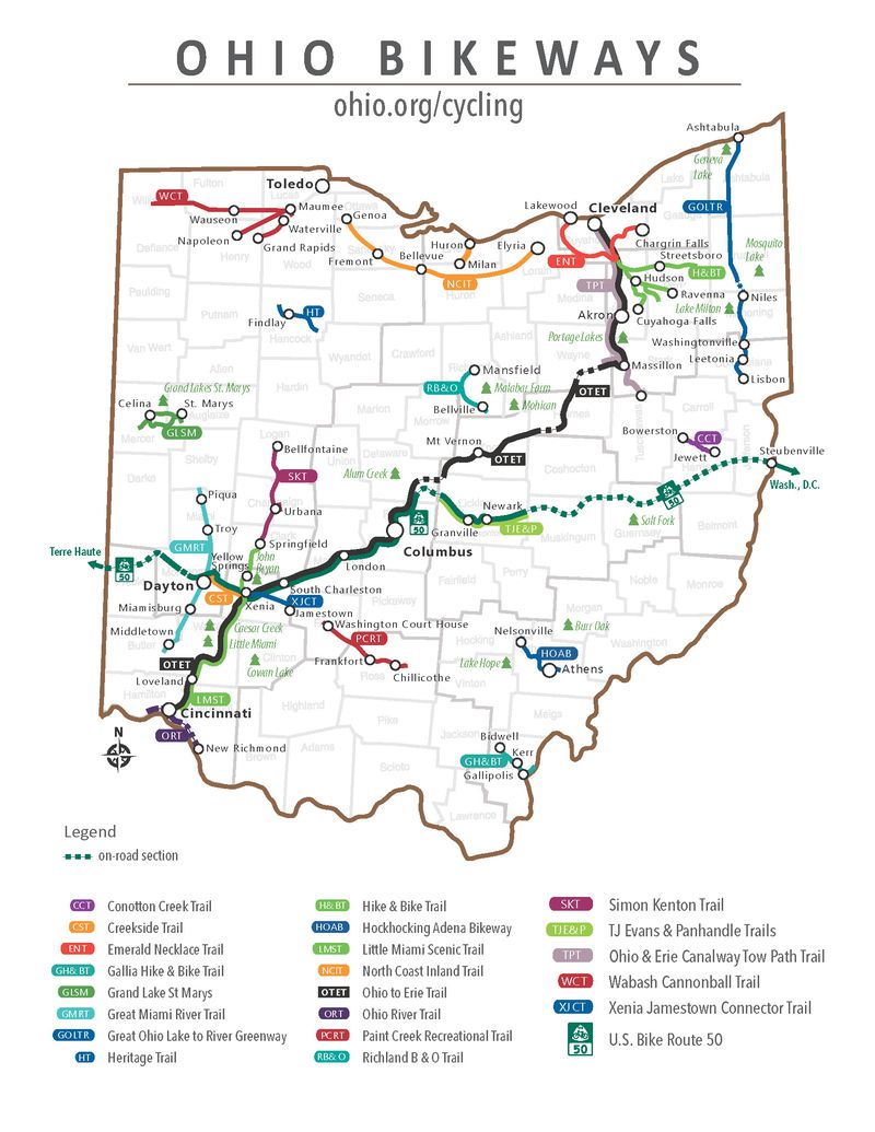
 as
3. Ohio's Cycling Trails as Presented on Ohio.org (2020)
Picture
Proudly powered by Weebly
  • County Info and Trail Connections
    • Portage Parks Trails
    • Portage County Road Resources
    • Road Info for Nearby Counties
    • Connecting to the Western Reserve Greenway
    • Connecting to the Mill Creek Metroparks Bikeway
    • Connecting to the Towpath Trail
    • Connecting to the Maple Highlands Trail
    • Mahoning Valley and Iron Horse Trails
    • Connecting to Parma and the Northern Tier Route at Lakewood
    • Future Trails and Connections
  • Longer Trips - Cycle Touring
    • Planning a Bike Tour
    • The Ohio to Erie Trail
    • Ohio to Erie Trail Alternate to Ashtabula
    • The Erie Canalway Trail
    • North Bend Rail Trail, WV
    • Greenbrier River Trail, WV
    • Ghost Town Trail (and Hoodlebug)
    • Pine Creek Rail Trail (PA)
    • The GAP and C&O >
      • Connection by Trail to Reagan Airport
    • Cleveland Bypasses for the Northern Tier Route
    • Overview Maps
  • Beer:30 on the Bike Trail
  • E-bike Regulations
  • Contact
  • Blog