Are you picking up or dropping off a rental car? It is easy to connect to the airport via a great system of paved trails. The route below will get you to an underpass that enters the service yard for the rental card companies. You may encounter some detours from the trails due to construction. These were well marked in late 2021 and took us through the Kennedy Center property. Our route took us across the George Mason Memorial Bridge. While it may look feasible to cross the Potomac via the Arlington Memorial Bridge, signage indicates there is no trail connection on the Virginia side.
The Rentals are located in Garage A. It will help to know in advance which floor your rental company occupies. When in doubt, ride to the elevators in the front of the building and use them to locate your vendor.
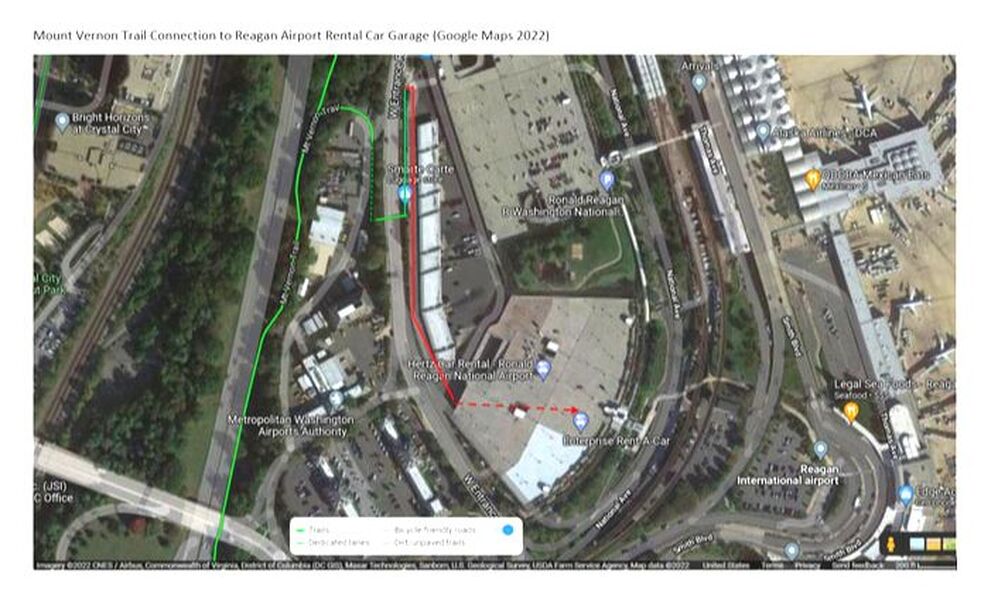
The unfortunately grainy image below the map will give you some idea of your route after you leave the underpass beneath W. Entrance Rd. Contrary to the current Google image, you'll need to make a left out of the tunnel and head north up a ramp to street level again (indicated on the photo below). You will then roll to your right into the rental car maintence yard, avoiding the "spike strips" installed in the pavement to prevent unauthorized auto access. You can then backtrack south (see red line), keeping the maintence bays on your left, and W. Entrance Rd. on your right. You can ride into the garage. Some rental companies are on this level, but use the elevator in the front of the building to access other levels and rental desks. The floors will be labeled "A1, A2, etc." in the elevator.
Need to change? There are fairly large restrooms near the Rental Desks!
The Rentals are located in Garage A. It will help to know in advance which floor your rental company occupies. When in doubt, ride to the elevators in the front of the building and use them to locate your vendor.
The unfortunately grainy image below the map will give you some idea of your route after you leave the underpass beneath W. Entrance Rd. Contrary to the current Google image, you'll need to make a left out of the tunnel and head north up a ramp to street level again (indicated on the photo below). You will then roll to your right into the rental car maintence yard, avoiding the "spike strips" installed in the pavement to prevent unauthorized auto access. You can then backtrack south (see red line), keeping the maintence bays on your left, and W. Entrance Rd. on your right. You can ride into the garage. Some rental companies are on this level, but use the elevator in the front of the building to access other levels and rental desks. The floors will be labeled "A1, A2, etc." in the elevator.
Need to change? There are fairly large restrooms near the Rental Desks!